
Dear fishing friends, on behalf of Angler’s Atlas and myself, Mike Robertson of the Bow River Blog, I am asking for your help in collecting data on our fisheries and waterways here in Alberta and beyond. As some of you may, or may not know, there is an urgent need to collect data from lakes and rivers across Canada. Traditional survey methods are expensive, and as a result, thousands of water bodies are left unmonitored. The MyCatch app is designed to help solve this problem with your help! Collective data will help all of Canada’s fisheries!
What is MyCatch App?
MyCatch app is a citizen scientist application which assists fishery biologists in getting real time data from anglers about catch rates, species distribution and other research topics. MyCatch is a simple way to track each one of your catches and assist fisheries biologists in getting real time data from anglers just like you. We are looking for data on distribution and other research topics. Check it out here https://www.anglersatlas.com/mycatch.
Will my secret spots be revealed?
Many anglers like to keep their “honey holes” or secret spots they fish confidential, and we can all respect that. We can assure you that NONE of your secret locations will be shared or compromised! Your secret spots will remain secret, while we collect the data needed to enhance our fisheries, and waterways in Canada. As any seasoned angler knows, having a catch log is a great way to keep personal fishing logs, and the MyCatch App is the perfect compact application to store this information all in one place. It is a win for the fisheries biologists, and a win for the angler.
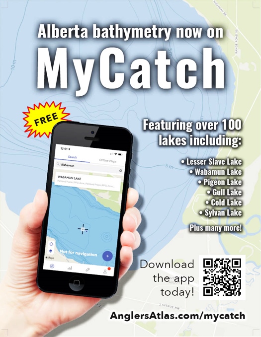
Bathymetric Maps Included!
What is a bathymetric map? A bathymetric map/chart is a type of isarithmic map that depicts the submerged topography of oceans, sea bottoms, lakes and reservoirs. Their primary purpose is to provide detailed depth contours of lakes, or reservoirs, as well as provide the size and shape distribution of underwater features. MyCatch app as a simple way to track your catches for anglers, which now has bathymetric maps in Alberta. Please head over to download the MyCatch app here https://www.anglersatlas.com/mycatch and help us help the fisheries in Alberta now. The fisheries and waterways will greatly benefit from your help!
Thank you,
~Mike Robertson
Angler’s Atlas